Kyushu in summer, day to day
Kyushu in summer is hot, and in the southern parts of the island it is tropical in feel. Temperatures through July and August sit in the mid to upper thirties across most of the island, and the humidity that comes with the season makes the heat feel heavier than the numbers alone suggest. Fukuoka and the northern cities manage it the way large Japanese urban centres do, efficiently, with air conditioning and covered spaces absorbing the worst of the day, but further south in Kagoshima and toward the subtropical islands the heat becomes a more constant and unavoidable presence that shapes the rhythm of the day from the moment you step outside.
The rainy season hits Kyushu earlier than the rest of Japan, typically arriving in late May or early June and clearing by mid July. Kyushu receives some of the heaviest rainfall in Japan during this period, not the grey, drizzly rainy season that other parts of the country experience, but at times intense and prolonged rain that can affect transport, trail access, and outdoor plans significantly. Building flexibility into an itinerary that overlaps with the rainy season is practical advice rather than excessive caution. Once it clears the summer skies that follow are typically clear and bright, though the typhoon season that runs from late summer into autumn means that weather can shift quickly and unpredictably through August and September.
Outside of the weather considerations Kyushu's summer has a lot going for it. The island's hot spring towns, Beppu and Yufuin in Oita in particular, are counterintuitively enjoyable in summer, and the contrast between the outdoor heat and a properly hot onsen is a distinctly Japanese summer experience. The volcanic landscapes around Mount Aso in Kumamoto and the dramatic scenery of the Kirishima range in Kagoshima are at their most vivid and green through the summer months, and the rural interior of the island is beautiful when the weather cooperates.
Clothing is light and minimal for the heat, with sun protection worth taking seriously across the whole island and particularly in the south where the UV intensity is higher than most visitors expect. A reliable rain layer that is properly waterproof rather than just water resistant is more important in Kyushu's summer than in almost any other region given the rainfall levels. Getting around the island in summer is easy on the main routes, though rural roads in areas that receive heavy summer rain can be affected and it is worth checking conditions before heading into the more remote interior.
Okinawa in Summer
Okinawa in summer is the peak season for the archipelago and the reasons are obvious. The water is warm, the skies are blue on the good days, and the beaches and coral reefs that define the islands are at their most accessible and most visited. It is also, in full honesty, the most demanding season to be there. July and August bring heat and humidity that sit consistently in the low to mid thirties with a moisture level that makes the air feel thick and heavy through the middle of the day. The UV intensity is high, the crowds on the main island are at their largest, and the typhoon season that runs through summer and into autumn means that weather can shift from clear and calm to severe within a short window.
That typhoon risk is the most significant practical consideration for summer travel to Okinawa and the outer islands. Typhoons can disrupt ferry services, close beaches, and in more serious cases affect flights and accommodation in ways that are difficult to plan around. Travel insurance that covers weather disruption is worth having, and building flexibility into an itinerary, particularly around travel between islands, is sensible rather than overcautious. The flip side is that the days between typhoons in summer Okinawa can be spectacular, with the kind of clear water visibility and open sky that justifies the islands' reputation as one of the best diving and snorkelling destinations in East Asia.
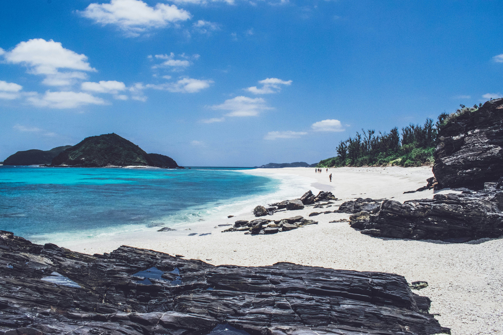
The outer islands handle summer differently to the main island. Ishigaki and the Yaeyamas draw significant visitors through July and August but the scale is still manageable compared to the main island, and the more remote islands in the group remain quiet even at the height of the season. Iriomote in particular, largely covered by jungle and with limited accommodation, stays off the mass tourism radar even in summer and offers a version of Okinawa that feels far removed from the beach resort atmosphere of the main island. Getting to and between the outer islands in summer requires flexibility given the potential for ferry and flight disruption during typhoon activity.
Clothing is minimal and practical, light swimwear and casual summer clothing cover most situations, with reef safe sun protection essential given the UV levels. Staying hydrated through the middle of the day matters more in Okinawa's summer than in most other parts of Japan, and the combination of heat, humidity, and outdoor activity adds up quickly. Accommodation across the archipelago books out well in advance for the peak summer weeks, particularly on the smaller outer islands where capacity is limited. Planning ahead is not optional if specific islands or properties are important to your trip.
Exploring Kyushu
Yakushima Island (屋久島)
A mountainous World Heritage island off southern Kyushu, with ancient cedar forests, granite peaks, and waterfalls in almost constant rain.
The Jomon Sugi (縄文杉) is the largest and best known of the ancient Yakusugi cedars on the UNESCO World Heritage island of Yakushima (屋久島) off the southern coast of Kagoshima Prefecture, 22.2 metres tall with a girth of 16.1 metres, standing at 1,328 metres in the mountain interior in a primeval rainforest where the saying goes that "it rains 35 days a month". Its age depends on the method used, and Yakushima Town gives a range of 2,170 to 7,200 years while the Kyushu Regional Forest Office of the Forestry Agency puts it at 1,300 to 3,600 with a central figure of 2,400. The trail from the Arakawa Trailhead is 22 kilometres round trip with around 700 metres of ascent and takes 8 to 10 hours, the first 8 kilometres running along the Anbo forest railway, the only forest railway still working in Japan's national forests, and the upper section climbing a steeper path of ladders and roots. It passes the Wilson's Stump, the hollow remains of a giant cedar that Yakushima Town records as felled about 300 years ago and named after the American botanist who surveyed the yakusugi in the Taisho era, the Daio Sugi Great King Cedar radiocarbon dated in 1983 to 3,030 years give or take 160, and the Meoto Sugi Husband and Wife Cedars, two trunks joined by a shared branch, before reaching a wooden observation deck set back from the base of the Jomon Sugi to keep feet and hands off its roots. The wider island was registered in 1993 as Japan's first UNESCO World Natural Heritage Site and has mountain peaks rising close to 2,000 metres above the Pacific. Summer brings the heaviest rain, the highest humidity and the most heat of the year to this walk, so it is started before dawn to be off the mountain before the afternoon thunderstorms build. The first Arakawa shuttle buses leave the Yakusugi Museum at 5:35, which means a hotel departure around 5:00 and a night in Anbo beforehand if you want the earliest one. Private vehicles are barred from the trailhead road every year from 1 March to 30 November, so the shuttle is the only way in, at ¥2,000 one way or ¥3,000 return, each of which includes the ¥1,000 mountain conservation fee. Tickets are sold in advance rather than on the bus, at the Anbo, Miyanoura and airport information offices, the Yakushima Environmental Culture Village Centre and the Yakusugi Museum bus stop. Most walkers go with a licensed local guide, and day trip prices are set per group so the cost per person falls sharply as the party grows, with bus fares, the conservation fee and lunch normally charged on top. Trekking shoes, full rain gear and a covered daypack are the minimum, and rental shops in Miyanoura and Anbo carry them. From Kagoshima the flight to Yakushima Airport takes around 40 minutes, with the Toppy and Rocket jetfoils to Miyanoura Port taking 1 hour 50 minutes direct and up to 2 hours 45 minutes on sailings that call at Tanegashima.
Takachiho Gorge (高千穂峡)
A gorge of columnar cliffs cut by the Gokase River in northern Miyazaki, rowed by hand under the Manai Falls in the summer heat.
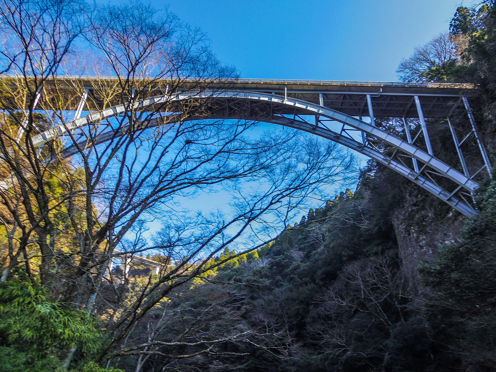
Takachiho Gorge (高千穂峡) runs for around 7 kilometres through the town of Takachiho in Nishiusuki District in the north of Miyazaki Prefecture, where the Gokase River has cut down through pyroclastic flow deposits thrown out by eruptions of Mount Aso and left walls of columnar jointing standing on both banks. Takachiho Town gives the average cliff height as around 80 metres, rising to about 100 metres at the tallest points, and the gorge was designated a national place of scenic beauty and natural monument in 1934 under the name Gokasegawa Kyokoku, becoming part of the Sobo-Katamuki Quasi-National Park in 1965. The Manai Falls (真名井の滝) drop about 17 metres straight into the river at the narrowest point and are on the list of Japan's 100 selected waterfalls. Rowing boats are what most people come for in summer, taken out from the boat house in the gorge to sit under the falls with the rock closing overhead. The town charges ¥4,100 to ¥5,100 per boat for 30 minutes, with a maximum of three people or four where preschool children are included, and ¥1,000 for every additional 10 minutes. Boats are booked in advance through the tourism association's online reservation system rather than bought at the water's edge, and they are suspended whenever the river runs high, which in a Kyushu summer means the tail of the rainy season in July and the days around any typhoon, so keep a fallback in the plan. A walking path of about 1 kilometre runs the length of the gorge for anyone who does not get on the water, and the shade and the river make it noticeably cooler down there than in the open country above. Note that the outdoor lighting along the gorge is switched off for several weeks in late spring so the fireflies can breed, a suspension that ran from 26 May to mid June in 2025. All four car parks now charge, the first at Oshioi and the second at Ararugi at ¥1,000, and the third at Ohashi at ¥800 and the fourth at Oshikata at ¥500 since 1 April 2026, the last two with the first 60 minutes free.
Yufuin Kinrinko Lake (由布院 金鱗湖)
A small spring fed lake at the foot of Mount Yufu in the onsen town of Yufuin, fed by cold springs and a hot spring together, so the water stays warm right through the year.
Yufuin (由布院) is a highland hot spring resort town in Yufu, Oita, at the foot of the twin peaked Mount Yufu, with around 850 hot springs feeding the town's many ryokan that rank Yufuin among Japan's top three onsen destinations in both volume of water and number of sources. The Kinrinko Lake (金鱗湖) at the edge of the town is the most photographed spot in Yufuin, a small lake fed by fresh water springing from the lake floor and a hot spring streaming in that keeps the water temperature high through the year, with a small torii gate on the lakeshore and the twin peaks of Mount Yufu rising behind. The famous mist that rises from the lake in the early morning is an autumn and winter phenomenon when the cold outside air meets the warm lake water, with summer visits offering a different character of green pastoral scenery around the lake and the wider basin instead. The Yunotsubo Kaido (湯の坪街道) main street between the train station and the lake is lined with souvenir shops, galleries, restaurants and the Yufuin Floral Village shopping area, with the alkaline simple hot springs at most ryokan offering open air baths looking out to Mount Yufu. From Hakata Station the Yufuin no Mori Limited Express runs directly to Yufuin Station in around 2 hours 16 minutes for ¥5,690.
Mount Aso (阿蘇山)
One of the world's largest active volcanic calderas, with the Nakadake crater, the grass plain of Kusasenri and the view over the Five Peaks from Daikanbo, green and cool through summer.
Mount Aso (阿蘇山) sits at the centre of one of the world's largest active volcanic calderas, with the caldera floor holding the Aso Five Peaks (阿蘇五岳) of Takadake (1,592m, the highest), Nakadake, Nekodake, Eboshidake and Kishimadake, with the still active Nakadake crater the headline feature. Nakadake erupted as recently as 2016 and 2021, and the crater's no entry zone was lifted on July 25th 2025 after several years of restriction, though it can still close at short notice based on volcanic gas levels, weather and the alert status set by the Japan Meteorological Agency, so visitors should always check the official Aso Volcano Disaster Prevention Council website on the morning of the visit. Summer is when the caldera is at its greenest, and the highland air stays cooler than the lowland Kyushu cities, with long daylight hours that suit the full driving and walking circuit. Kusasenri-ga-hama (草千里ヶ浜), the grass covered floor of an ancient crater roughly 30,000 years old, is the heart of the caldera, with walking trails around its rainwater ponds, seeing Japanese brown cattle and horses grazing across the plain, horse riding along a guided 5 minute course at around ¥1,500, and the Aso Volcano Museum on its rim. The Kusasenri loop trail climbs the side of Mt. Eboshi on staircases and boardwalks for an aerial view back over the plain, with Kyushu azaleas (ミヤマキリシマ) flowering in early summer along the route. The northern outer rim viewpoint at Daikanbō (大観峰) opens out over the entire caldera and the silhouette of the Five Peaks lying on their backs, commonly called the Reclining Buddha. Buses run from JR Aso Station to Asosanjō Terminal at the crater base every 1 to 2 hours for around ¥1,000 one way, stopping at Kusasenri along the way, and a rental car opens up the wider caldera circuit including Daikanbō and the Minami-Aso villages on the southern side. Aim for an early start from Aso town since afternoon mist often closes in over the peaks and reduces the views, and pack a windbreaker even in August because the highland temperature at the crater rim runs noticeably cooler than the caldera floor.
Exploring Okinawa
Kerama Islands (慶良間諸島)
An island group west of Naha known for the clear water called Kerama Blue, with coral reefs, snorkelling, and white sand beaches.
The Kerama Islands are a group of small islands approximately 30 kilometres west of Naha and the coral reefs that surround them are designated a national park and widely considered the finest accessible diving and snorkelling destination in Okinawa. Summer is the primary reason to visit specifically because the warm water temperatures through July and August bring the coral reef ecosystem to its most active and most biodiverse seasonal condition, the coral spawning events that occur through the summer months, the visibility that reaches 30 metres or more in the clear Kerama waters, and the density of marine life including sea turtles, manta rays, and the full range of tropical reef fish makes summer diving and snorkelling here a world class experience. The 座間味島 (Zamami Island) and 渡嘉敷島 (Tokashiki Island), the two most accessible of the main Kerama islands, have small beaches of extraordinary quality that are swimmable directly from shore without a boat, and the combination of the beach swimming and the guided snorkelling tours that operate from both islands through summer gives the Kerama visit a range of water engagement that suits different levels of experience and commitment.
Miyako Island (宮古島)
A flat coral island in the southern Okinawa chain, with some of Japan's clearest water and long white beaches linked by bridges.
Miyako Island sits approximately 300 kilometres southwest of the Okinawa main island and is home to some of the finest beaches and clearest water in Japan, a combination that summer makes most specifically appropriate and most fully accessible. The 与那覇前浜ビーチ (Yonaha Maehama Beach) on the southwestern coast of the island, consistently rated among the finest beaches in Japan for the quality of the white sand and the clarity of the shallow turquoise water, is at its most swimmable and most alive through July and August when the water temperature and the summer conditions make extended time in and around the water pleasurable rather than simply scenic. The 伊良部大橋 (Irabu Bridge), the longest toll free bridge in Japan at 3.5 kilometres, connecting Miyako Island to the adjacent Irabu Island, gives views across the summer sea from both sides of the bridge that in the right light conditions produce one of the most vivid turquoise water panoramas available from a road surface anywhere in Japan. The coral reefs surrounding Miyako Island support summer diving conditions of exceptional quality and the combination of the beach, the bridge, and the reef gives the island a summer range that rewards at least two to three days of exploration.
Kouri Island (古宇利島)
A small coral island off the Okinawa main island, reached by a long bridge over turquoise water, with quiet beaches and a heart shaped rock.
Kouri Island in summer is most specifically worth visiting for the beaches on the northern and eastern coasts of the small island that are swimmable and snorkelable directly from shore, the 古宇利ビーチ (Kouri Beach) on the northern tip of the island has sand and water of exceptional quality and in summer the water temperature and clarity make it one of the most accessible and most rewarding swim and snorkel beaches reachable by car from the northern Okinawa main island without a ferry crossing. The view from the 古宇利大橋 (Kouri Bridge) crossing in summer, looking down into the turquoise shallow water on both sides of the causeway with the island visible ahead, is most dramatically coloured through July and August when the sun angle and the summer light intensity give the water its most vivid and most saturated blue green colour. The 古宇利オーシャンタワー (Kouri Ocean Tower) on the island hilltop gives the most elevated view across the summer sea and the surrounding island coastline that the ground level beach experience cannot provide, and the combination of the tower view, the bridge crossing, and the beach swimming gives summer on Kouri Island a range that rewards spending a full day on the island rather than simply crossing the bridge.
Iriomote Island (西表島)
A World Heritage island of jungle, mangrove river and waterfall in the far southwest, worked by kayak and on foot rather than from a beach towel.
Iriomote Island (西表島) sits at the western end of the Yaeyama group in Taketomi Town and is the second largest island in Okinawa Prefecture after the main island. Okinawa Prefecture describes almost the whole of it as national park, mostly under primeval forest, with more than 2,500 millimetres of rain a year feeding the Urauchi and Nakama rivers and the largest mangrove forests in Japan along their lower reaches. UNESCO inscribed it on the World Heritage List in 2021 under natural criterion (x), as one of five component parts of the property Amami-Oshima Island, Tokunoshima Island, Northern part of Okinawa Island, and Iriomote Island, which covers 42,698 hectares and was recognised for its endemic species. The Iriomote cat, first described in 1967 and made a special natural monument in 1977, lives on this island and nowhere else, and the Iriomote Wildlife Conservation Centre puts the population at around 100 animals. Summer is when the rivers do the work. The Urauchi River jungle cruise runs upstream from the road bridge at ¥3,500 for adults and ¥1,750 for children, with sailings at 9:00, 10:00, 11:30, 12:30 and 14:30, and from the upstream landing a forest path leads on to the Mariyudu Falls, which are on the list of Japan's 100 selected waterfalls, and the wide stepped Kanpire Falls above them, whose name is understood locally to mean the seat of the gods. The Pinaisara Falls (ピナイサーラの滝) on the Hinai River drop around 55 metres, which Taketomi Town records as the longest fall in Okinawa, and are reached by paddling a kayak through the mangroves and then walking, the standard guided day out here. At the eastern end a water buffalo cart crosses the shallows to Yubu Island and its subtropical garden, at ¥2,000 for adults and ¥1,000 for primary school children including admission, running from 9:15 to 16:30 with last entry at 15:45 and opening later on a high tide. There is no airport, so everything comes in by high speed ferry from Ishigaki, around 40 to 60 minutes to Uehara Port in the west or 35 to 40 minutes to Ohara Port in the south, and Taketomi Town notes that when bad weather closes the Uehara route a free bus is sometimes laid on from Ohara to the western districts instead. Summer here is hot, wet and inside the typhoon window, so treat the crossing as the part of the day most likely to change.
Experiences in Kyushu
Now that you have a sense of how the season runs here, these are the highlights and experiences worth building the trip around.
Experiences in Okinawa
Now that you have a sense of how the season runs here, these are the highlights and experiences worth building the trip around.
Prefecture map
Food in Kyushu
Cold miso soup over rice
Miyazaki's chilled soup poured over barley rice, built for eating fast in the heat.
冷や汁 (Hiyajiru) is Miyazaki's answer to working through a subtropical summer. Grilled fish, usually sea bream or horse mackerel, is flaked and pounded into miso with toasted sesame, sometimes peanuts, then let down with cold dashi and poured over 麦飯 (mugimeshi), barley rice, with cucumber, shiso and myoga through it. It came from farm labour. The origin is field workers putting raw miso on barley rice and adding water, because there was no time and no appetite for anything hot, and rice was scarce enough in rural Miyazaki that barley was the staple. Grilling the miso first is what lifts it from expedient to good. It is still served at family gatherings at Obon, and it is now on menus across the prefecture through the summer. Cold, salty and savoury rather than refreshing in a sweet way, which is why it works when nothing else appeals.
Shiroshita flounder
Oita's flounder from the spring fed seabed below Hiji Castle, best from May into early July.
城下かれい (Shiroshita Karei) is マコガレイ (makogarei) caught in one specific patch of 別府湾 (Beppu Bay), off 日出町 (Hiji Town) in Oita, and the name means below the castle. Fresh water wells up through the seabed there from springs beneath 日出城 (Hiji Castle), and the mix of fresh and salt water is the local explanation for the fish, which is white, firm fleshed and without the muddy note flounder can carry. The season runs April to September and the best of it is May into early July. It has a documented history as a tribute fish, with dried specimens sent to the shogun's household in the Edo period and live fish carried up to Edo for the Boys' Festival in leap years. It is eaten as 洗い (arai), sliced thin and shocked in cold water so the flesh tightens, or simply grilled, and the restaurants and ryokan along the Hiji seafront run a set menu around it through the season.
Wild rock oysters
Summer oysters, dived rather than farmed, from the Goto Islands and the Ariake Sea, May to mid August.
岩牡蠣 (Iwagaki) is the oyster that runs on the opposite calendar to the one most people know. The season is May to mid August, when the farmed winter oyster of Hiroshima is out of condition, and almost all of it is wild rather than cultivated, which means divers go down and lever it off the rock by hand. It takes two to three years to reach size against roughly one for the farmed kind, and it grows much larger and thicker shelled, with a deeper, creamier and more mineral flavour than a winter oyster. In Kyushu the names to look for are the 五島列島 (Goto Islands) off Nagasaki, the Ariake Sea side of Saga, and the 雲仙 (Unzen) coast, where they are sold as summer oysters. Eaten raw off the shell with citrus, or grilled in the shell over coals at the roadside 牡蠣小屋 huts along the coast.
Bitter melon
The bitter green gourd of the south, stir fried with egg and pork or tofu, strongly tied to summer in Kyushu and Okinawa.
Bitter melon is strongly associated with summer in the southern parts of Kyushu where the subtropical influence of Okinawa begins to make itself felt in the local food culture. The vegetable is harvested through the hottest months and has a pronounced bitterness that is an acquired taste but one that locals in this part of Japan are deeply attached to. It is most commonly eaten as ゴーヤチャンプル (Goya Champuru), stir fried with egg, tofu, and pork, a preparation borrowed from Okinawan cooking that has become a summer staple across the southern prefectures of the island.
Food in Okinawa
Mango
Okinawan mango at its peak from June to August, ripened on the tree and dropped into a net.
Mango is Okinawa's summer gift fruit. The main variety is アップルマンゴー (apple mango), the Irwin, grown under greenhouse cover across the islands, and the method is what puts the price on it. The fruit is left on the tree until it separates on its own, caught in a small net tied beneath it, so it is never picked early. That gives a fruit with no fibrous edge, heavily perfumed, and soft enough to eat with a spoon. The season runs June to August with the peak in July. Most of the crop is graded and boxed as 贈答用 (gift fruit) and sold at prices that reflect that, but the 訳あり (blemished) grade sold at roadside stands and farmers' markets on the islands is the same fruit at a fraction of the price. It is eaten fresh, and turned into shaved ice, parfaits and juice across the islands through the summer.
Yobuko squid
Saga's kensaki squid, served still moving and translucent, in season May to July.
呼子 (Yobuko) is a small port on the Genkai Sea coast of Saga that has built itself around one dish. The squid is ケンサキイカ (kensaki ika), swordtip squid, in season from May to July, and it is served as イカの活き造り (ika no ikizukuri). The squid is taken live from a tank, sliced, and put on the plate still moving, the flesh so fresh it is transparent rather than white and the texture closer to crunchy than soft. The service started at a Yobuko restaurant in the 1960s and the town now runs on it. The order comes in two parts, because the body goes out raw and the legs and wings go back to the kitchen to return as tempura or salt grilled, so one squid is eaten twice. Yobuko also runs a long established morning market along its main street, and the squid is dried on frames in the sea wind above the harbour.
Pineapple
Okinawa's pineapple harvest, running from Yaeyama up to the north of the main island, May to August.
Pineapple is grown commercially in Japan essentially only in Okinawa, which needs acidic soil and a subtropical climate, and the season runs May to August. The harvest moves geographically as it goes. It opens in the 八重山 (Yaeyama) islands in the far south and then works north to 東村 (Higashi Village), 国頭村 (Kunigami) and Nago on the main island, where the red clay soil of the Yanbaru suits it. Higashi Village is the centre of it, with around 180 growers and a pineapple festival in the summer. Varieties differ more than people expect. ボゴール, the snack pineapple, pulls apart in the fingers without a knife, and ピーチパイン is pale and smells of peach. Unlike the mango it is a field crop rather than a greenhouse gift fruit, sold cut at roadside stands and juiced everywhere, and the fruit is picked ripe because it does not sweeten after cutting.
Sponge gourd simmered in miso
Young luffa gourd simmered with pork belly and island tofu in miso, made through the April to September hechima harvest.
Sponge gourd simmered in miso is the Okinawan way with a vegetable that the rest of Japan mostly knows as a bath scrub. Nabera is the island word for hechima, the sponge gourd, and nbushi is the name for a dish sitting halfway between a simmer and a soup, in which vegetables or tofu are cooked with pork in miso. The gourds are cut young, while the flesh is still soft and faintly sweet and long before the fibrous interior sets, and the agriculture ministry's regional cookery archive records the hechima harvest running from early April to late September, which is exactly when the dish is made and eaten. The skin is scraped off and the flesh sliced on the diagonal, thin bite sized pieces of pork belly are rubbed with miso, and the two are fried in lard and then simmered gently until the gourd gives up the thick sweet liquid the islands call doo jiru. Drawing out the right amount of that liquid is the whole knack of the dish. Firm island tofu usually goes in near the end. Haebaru in the centre of the main island is one of the country's leading growing areas for hechima, and through the hot months the dish turns up in home kitchens, in hospital canteens and on restaurant menus across the prefecture.