
Hiking in Japan
Japan’s mountains are not separate from its cities and towns. Forest trails begin beside suburban stations, old roads cross between preserved post towns, and buses and ropeways climb into landscapes that would otherwise take days to reach. That makes it possible to add a short walk to a city stay or organise an entire trip around mountain routes.
The important distinction is not simply “easy” or “hard.” A paved temple path, a humid forest stage and a high alpine ridge ask for different footwear, timing and preparation. Start with the experience you want, then confirm the exact route, current access and weather rather than relying on a general description of the mountain.
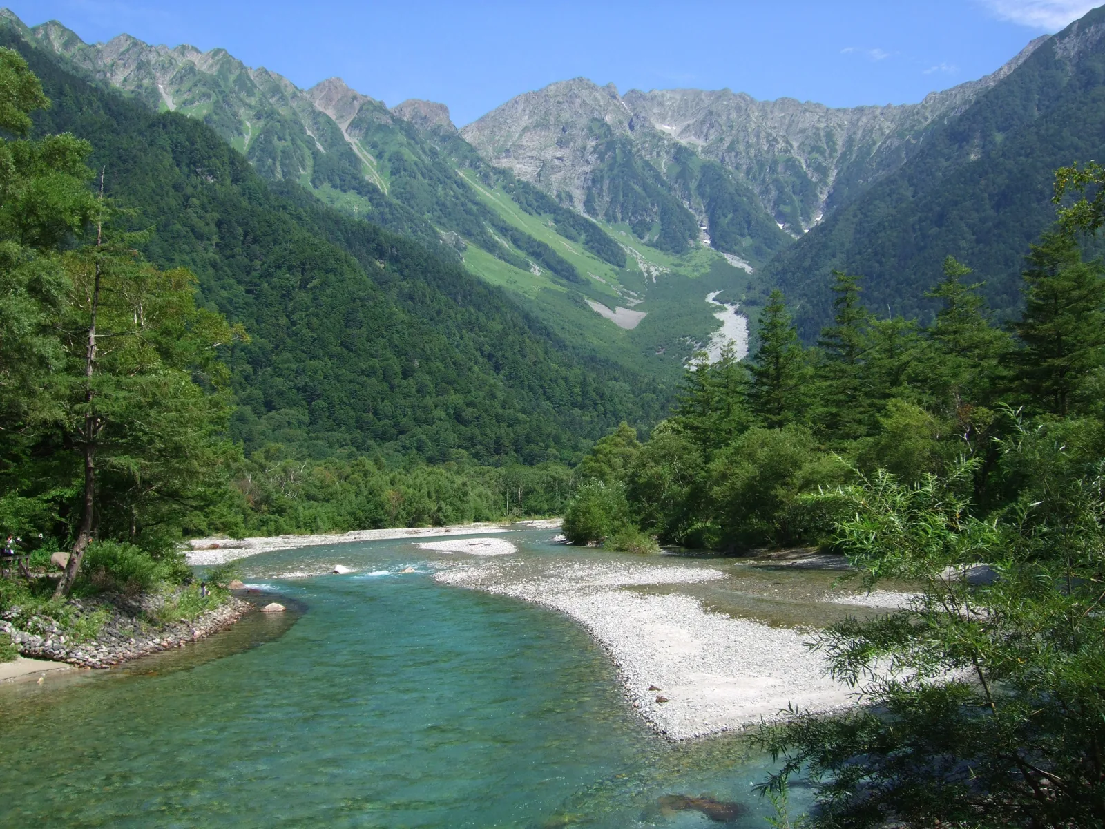
Choose the kind of walk first
A famous destination is not automatically the best fit. Decide how much of the day you want to give it, whether you are comfortable with sustained climbing and whether the route must finish near public transport or accommodation.
Short scenic walk
A maintained path, viewpoint or temple route that fits comfortably into a wider sightseeing day. These are the easiest to reach, but can still include steps, roots and slippery ground.
Check: total walking time, last transport and whether a ropeway is involved.Full day mountain hike
A route with several hours of ascent and descent, usually requiring an early start, proper footwear, food, water and a realistic turnaround time.
Check: elevation gain, trail condition, daylight and the return timetable.Historic or pilgrimage route
A trail where villages, shrines and former post towns are part of the experience. Some stages are gentle. Others cross steep, uneven mountain passes.
Check: stage length, luggage transfer, accommodation and road walking sections.Alpine or hut to hut route
High routes with exposed terrain, fast changing weather and a short season. These require mountain experience, careful planning and room to abandon the route.
Check: snow, hut dates, reservations, climbing registration and emergency options.Trails worth planning around
These examples show how different hiking in Japan can be. Times are broad planning estimates rather than promises. Breaks, weather, crowds and your pace can change them considerably.
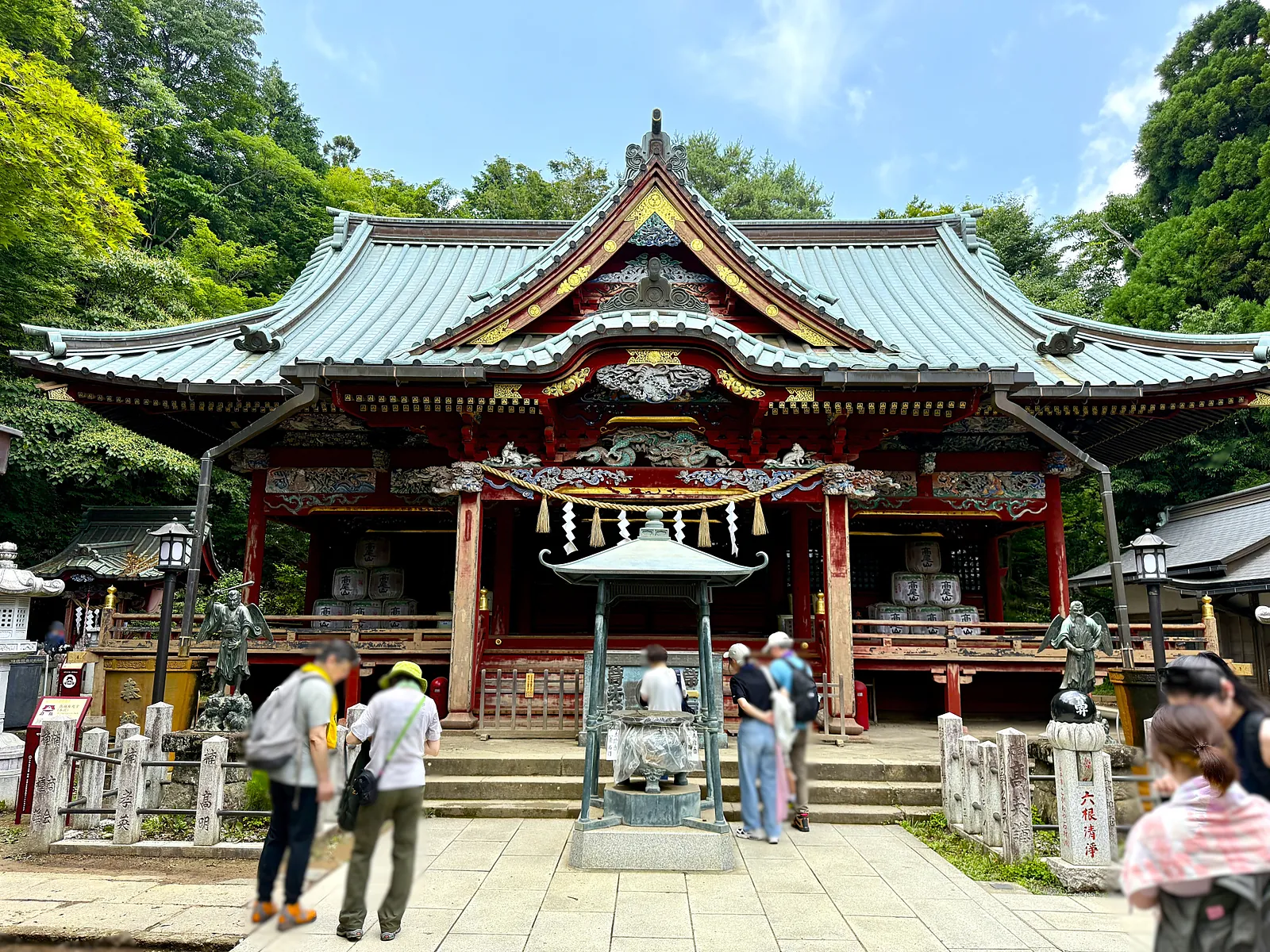
Mount Takao
Several marked trails climb from Takaosanguchi to the 599 metre summit, with a cable car and chairlift reducing the ascent if needed. It is convenient and beginner friendly, but weekends and autumn foliage periods can be extremely busy.
Best for: A first hike or an easy addition to a Tokyo stay.
Check: Which route you will use in each direction and the final cable car time.
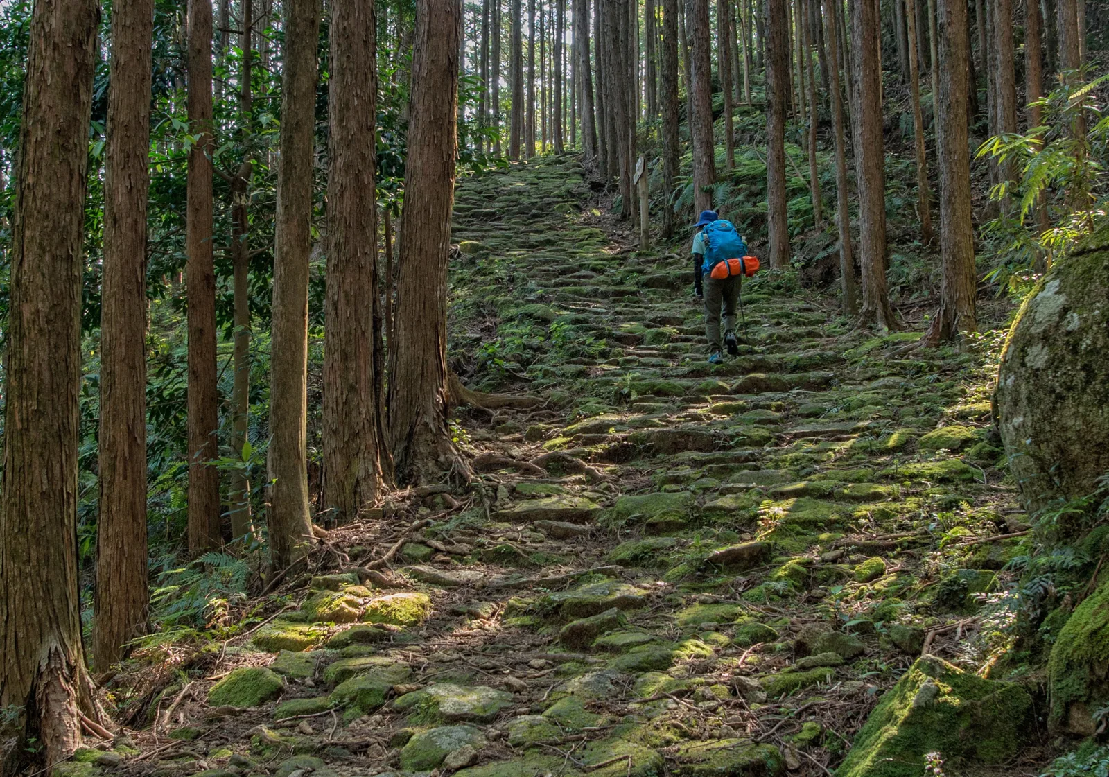
Kumano Kodo
The Kumano Kodo is a network rather than one trail. The popular Nakahechi can be divided into village to village stages, combining steep forest paths and sacred sites with small lodgings and hot spring towns.
Best for: Travellers who want walking, history and overnight stops together.
Check: The exact stage profile. A pilgrimage route is not automatically an easy walk.
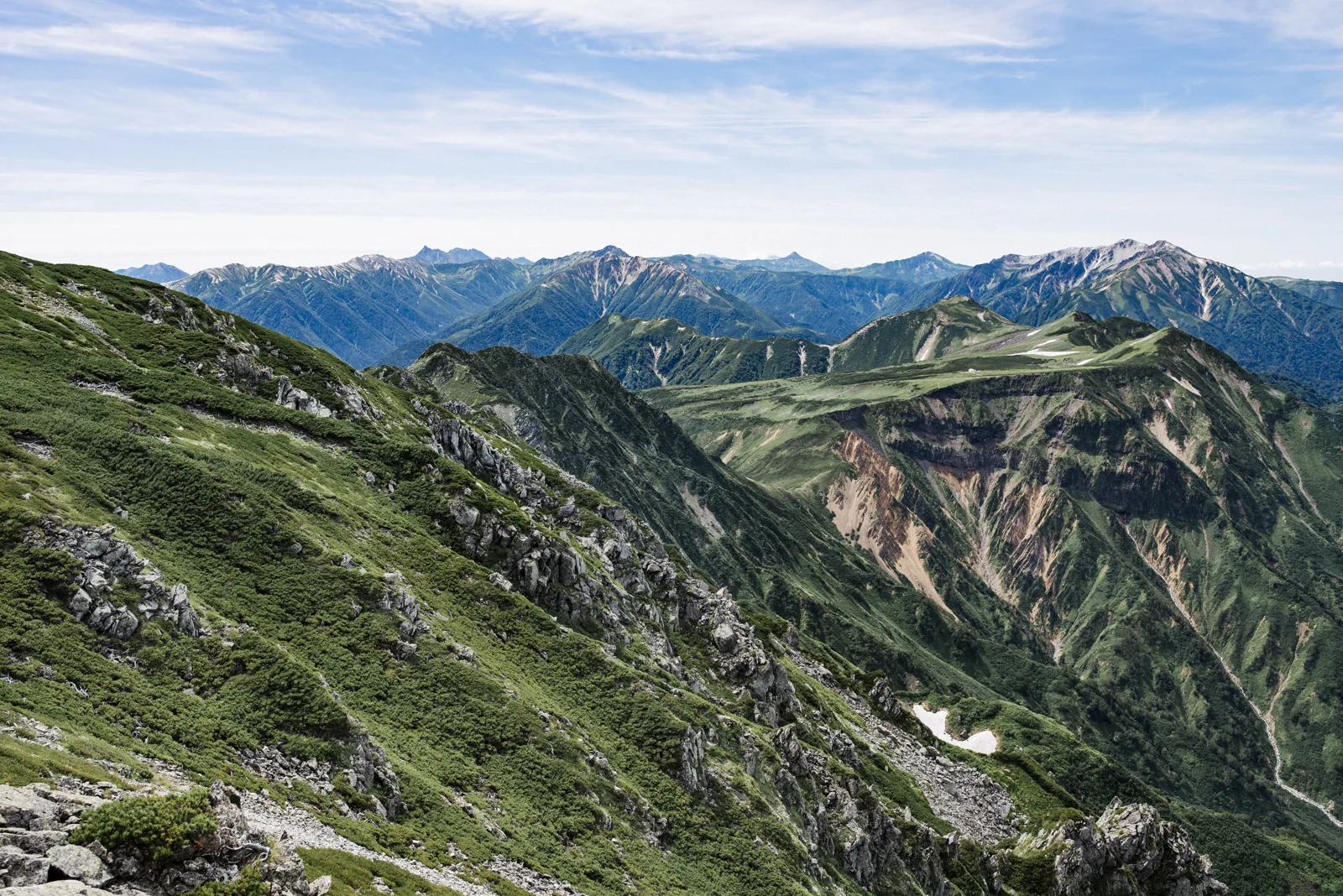
Tateyama from Murodo
The Alpine Route carries visitors to Murodo at about 2,450 metres, placing short scenic walks and serious summit routes in the same area. The convenient access does not remove the effects of altitude, exposed terrain or sudden weather changes.
Best for: Alpine scenery without beginning from the valley floor.
Check: Snow conditions, route difficulty and the last transport from Murodo.
Asahidake
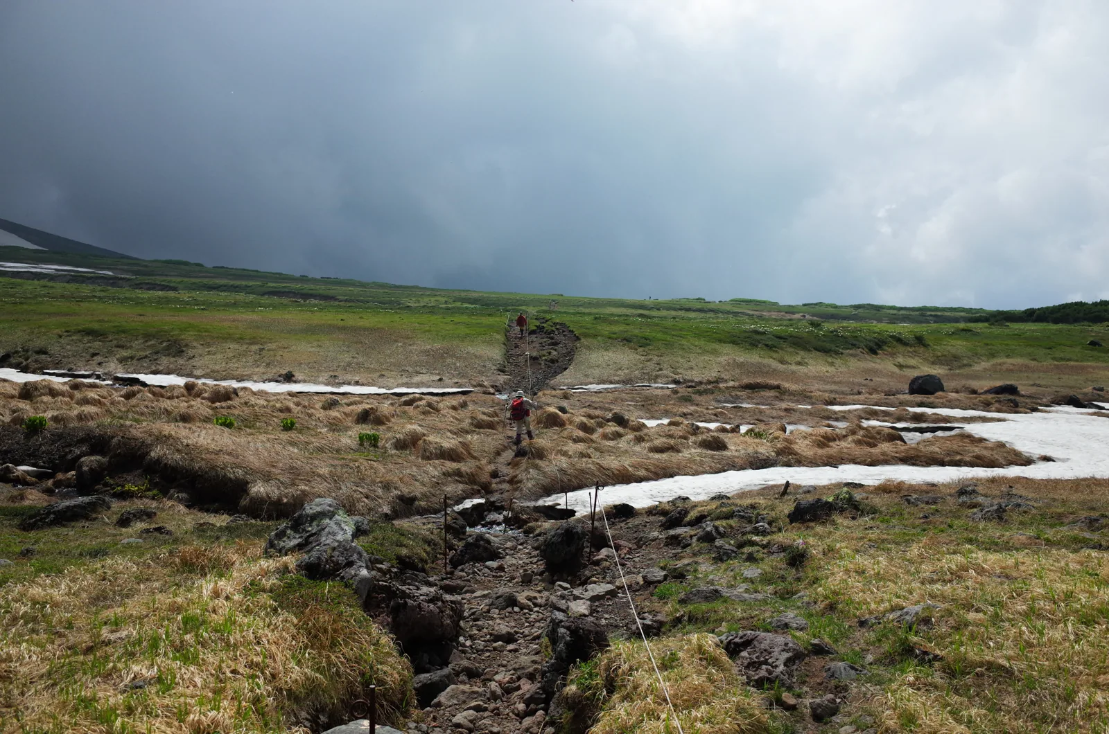
A ropeway reaches an exposed volcanic plateau beneath Hokkaido’s highest peak. The pond circuit is different from the summit ascent, and both sit in an environment where visibility and temperature can change quickly.
Best for: Volcanic scenery and Hokkaido’s earliest autumn colour.
Check: Wind, remaining snow and whether your plan is the pond circuit or summit.
Accessible and flexible
Good places to start, with easy access or ways to shorten the walk.
Fushimi Inari and Mount Inari
The familiar torii tunnels continue beyond the busiest lower shrine area, climbing through smaller worship sites and forest to a loop around Mount Inari. The route is stepped and paved for much of the way, but the repeated climbing is more demanding than the entrance photographs suggest.
Starting early gives you a quieter first section. Allow time to stop at the subsidiary shrines and viewpoints rather than treating the circuit as a race to a conventional summit.
Best for: Combining a substantial walk with one of Kyoto’s major sights.
Plan around: Crowds, summer humidity and the amount of stair climbing.
Kamakura Daibutsu course
This wooded ridge links the temple area around Kita-Kamakura with the Great Buddha side of the city. It feels removed from the streets for long stretches, but remains easy to combine with temples, cafés and the coast before or after the walk.
Roots, short climbs and muddy ground make it a trail rather than a paved sightseeing path. Sections may close following heavy rain or storm damage, so check locally before setting out.
Best for: A half day that mixes nature with Kamakura sightseeing.
Plan around: Recent rain, trail closures and time for the temples at either end.
Oze marshlands
Long boardwalks cross a highland marsh framed by mountains, with white skunk cabbage in early summer and gold grasses in autumn. The flat central landscape looks gentle, but reaching it can involve a descent from the trailhead that must be climbed again on the return.
Different access points create very different days, and seasonal buses may determine the route more than the walking distance does. An overnight hut stay gives more time in the marsh outside the busiest hours.
Best for: Wetland scenery and a walk with limited technical difficulty.
Plan around: Trailhead transport, boardwalk etiquette and the climb back out.
Longer day walks
Routes where distance, climbing or transport timing make preparation more important.
Magome to Tsumago
The best known Nakasendo stage follows old stone paving, lanes and forest tracks over a low pass between two preserved post towns. The route is clearly established and manageable for many regular walkers, with buildings and traces of the former highway giving the day a strong sense of place.
It is not entirely flat, and wet stone can be slippery. Luggage forwarding can let you walk with a daypack, but operating periods and collection times should be confirmed before arrival.
Best for: History, village scenery and a moderate point to point walk.
Plan around: Bus connections, luggage transfer and time in both towns.
Mount Mitake to Mount Otake
A cable car brings you close to the shrine village on Mount Mitake, but continuing towards Mount Otake turns the visit into a proper mountain day. The route passes forest, a mossy rock garden and waterfalls before climbing more steeply towards the 1,266 metre summit.
The cable car reduces the initial ascent rather than eliminating the mountain terrain. Allow time for the return, carry enough food and water, and do not judge the whole route by the easier paths around the shrine.
Best for: A genuine mountain hike reached from Tokyo.
Plan around: Steeper final sections, changing weather and the last cable car.
Mount Daisen
The usual summer route climbs steadily through beech forest before reaching more exposed upper slopes and a boardwalk near the top. Views can extend across the Sanin coast, while cloud or wind can make the same upper section feel far more serious.
Much of the ascent uses steps, so the descent can be tiring even when the route is easy to follow. Start early and check mountain conditions rather than relying on the weather forecast for the coast below.
Best for: A substantial standalone hike in western Japan.
Plan around: Repeated steps, exposed upper terrain and limited transport flexibility.
Major commitments
Short seasons, altitude or multiple days make these separate travel plans rather than casual additions.
Mount Fuji
Fuji’s four main trails cross exposed volcanic ground to 3,776 metres. They are summer routes for prepared hikers and need no technical climbing, but the combination of altitude, cold, crowds and a long descent makes the climb a separate travel plan rather than an extension of ordinary sightseeing.
Choose the route before booking transport or a hut, because the trailheads, walking times and entry procedures differ. Current fees, restrictions and opening dates should always be checked on the official climbing website.
Best for: Travellers prepared to organise the trip around one major climb.
Plan around: Entry rules, hut booking, altitude, weather and the descent.
Yari-ga-take
The distinctive spear shaped summit is reached by several demanding approaches, including multiday routes using mountain huts. Long ascent days, exposed ridges and the steep final summit section place it well beyond an ordinary sightseeing hike.
Exact difficulty depends on the chosen approach. Hut reservations, weather margins, route finding ability and comfort with exposed terrain all need to be considered before committing.
Best for: Experienced hikers building a trip around the Northern Alps.
Plan around: Route choice, hut dates, exposure and an alternative plan for bad weather.
Yakushima interior
Yakushima offers several very different forest experiences. Shiratani Unsuikyo can be adapted into shorter circuits, while the walk towards Jomon Sugi is a long day with an early start. The island’s rain, roots, timber walkways and transport schedules shape both more than the distance alone suggests.
Choose the exact route before deciding where to stay. Early buses, equipment rental and a guide may all be useful depending on the season, forecast and your experience on wet mountain trails.
Best for: Ancient forest scenery and travellers willing to plan around the walk.
Plan around: Heavy rain, slippery ground, early transport and route length.
Preparation and mountain safety
Published walking times are only a starting point. Look at elevation gain, surface, exposure and escape routes as well as distance. A short route can still be difficult when it is steep, snowy or far from transport. The JNTO nature guidance recommends researching the trail, alternatives and shelter before setting out.
Weather and daylight
Check a mountain specific forecast, start early and set a turnaround time. Rain can make roots and stone paths slippery, while thunderstorms, typhoons and early snow can make an otherwise familiar route unsafe.
Transport at both ends
Confirm the actual trailhead, seasonal buses and last service home. Mountain transport may run less often than city services, and two routes with the same mountain name can finish far apart.
Bears and wildlife
Bear presence and current advice differ by region. Check local notices, carry appropriate deterrents where recommended, make your presence known and never approach or feed wildlife.
Huts and climbing plans
Reserve huts where required and confirm meals, bedding, arrival times and payment. For higher or remote routes, file a climbing plan using the method requested by the prefecture or trailhead.
Mount Fuji has separate current rules. In the 2026 season, all four main routes required a ¥4,000 hiking fee, with time restrictions and route specific procedures. These arrangements can change, so use the official Mount Fuji climbing website when planning a future climb.
What to carry
Pack for the route rather than the season in the city below. Even a warm weather day can become cold, wet and windy at altitude.
For every trail
Water, food, charged phone, offline route information, sun protection, a small first aid kit and a way to carry all rubbish back out.
For a full mountain day
Supportive footwear, waterproof jacket and trousers, warm layer, spare socks, headlamp and enough reserve food and water for delays.
For alpine or overnight routes
Route specific equipment, emergency shelter, extra insulation, cash for huts and toilets, and any required reservation or climbing plan details.
When to go
Japan does not have one national hiking season. Elevation, latitude and snow matter more than the month alone, so confirm the current conditions for the exact trail.
Spring
Lower forest and historic routes become pleasant first. High mountains may remain under deep snow well into the season, even when nearby cities are warm.
Summer
The principal window for Mount Fuji and many alpine routes. Lower elevations can be hot and humid, with thunderstorms and typhoons requiring flexible plans.
Autumn
Often the clearest and most comfortable period for lower and mid level walks. Foliage starts early at altitude, while the first snow can close high routes.
Winter
Some low routes near cities remain walkable, but snow transforms mountain hiking into a different activity requiring suitable equipment and experience.
Common questions
Do I need a guide?
Not for every marked day walk. Consider one for remote alpine routes, winter or snow travel, difficult navigation, or when you want help understanding the landscape and local history. Check what the service includes before booking.
How reliable are the walking times?
Treat them as estimates for comparison. Your pace, breaks, crowds, weather and trail surface all matter. Plan around the last transport and daylight rather than assuming you will match the fastest published time.
Can I hike with ordinary trainers?
Some paved or short maintained walks may be suitable in shoes with good grip. Rough, wet, steep or alpine routes need footwear chosen for the terrain. New boots should be worn in before a major hike.
Can luggage be forwarded between walking stages?
On some established routes, including parts of the Nakasendo and Kumano Kodo, accommodation or local operators offer transfer services. Availability, cutoff times and service areas vary, so arrange it before beginning the stage.
Are trails always open outside winter?
No. Landslides, typhoons, volcanic activity, wildlife, remaining snow and transport closures can affect access at any time. Check the official local source shortly before travelling and again on the day.